Hiking in Northwest Arkansas' National Parks
In celebration of National Public Lands Day, spend some time outside. There are two National Parks in the Northwest Arkansas region. Each one has unique features that are worth the visit. Here is a quick breakdown of each:
Hiking in Buffalo National River
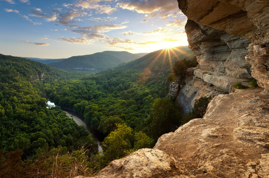
Nestled in the picturesque Ozark Mountains of Arkansas, Buffalo National River is a haven for outdoor enthusiasts and nature lovers alike. Established as the nation's first national river in 1972, this pristine waterway winds through rugged terrain, offering breathtaking views and a wealth of recreational opportunities. One of the best ways to experience the natural beauty of this region is by embarking on its numerous hiking trails. In this article, we will explore some of the most captivating hiking trails within Buffalo National River and provide you with the essential information to plan your adventure.
-
- Location: Ponca, AR
- Length: 2.3 miles (round trip)
- Difficulty: Easy
- Trail Details: Lost Valley Trail is a family-friendly hike that takes you through a lush, enchanting forest. Along the way, you'll encounter multiple picturesque waterfalls, towering bluffs, 200 ft cave with a waterfall inside, and the stunning 53 foot Eden Falls. The trail's accessibility makes it perfect for hikers of all skill levels.
-
- Location: Compton, AR
- Length: 5.8 miles (round trip)
- Difficulty: Moderate
- Trail Details: Hemmed-In Hollow Trail is a challenging but rewarding trek for experienced hikers that leads to one of the tallest waterfalls between the Rockies and the Appalachians. The 209-foot waterfall is a spectacular sight, making this hike a must-do for experienced hikers.
-
Indian Rockhouse Trail
- Location: Jasper, AR
- Length: 3.5 miles (round trip)
- Difficulty: Moderate
- Trail Details: Indian Rockhouse Trail takes you on a journey through the history of Buffalo National River. Along the way, you'll encounter a fascinating rock shelter used by Native Americans hundreds of years ago. The trail offers stunning views of the river and surrounding cliffs.
-
- Location: Ponca, AR
- Length: 5.4 miles (one way)
- Difficulty: Moderate
- Trail Details: Centerpoint Trail is a fantastic point-to-point hike that provides a sweeping panorama of the Buffalo River valley. The trail is often combined with other connecting trails including Chimney, Rock Trail, Sneeds Creek Trail, Big Bluff Trail, Compton Loop Trail, and Hemmed in Hollow, creating longer backpacking opportunities.

-
- Location: Various access points along the river
- Length: Approximately 40 miles (in Buffalo National River, much longer overall)
- Difficulty: Varies
- Trail Details: The Buffalo River Trail is a long-distance trail that follows the meandering path of the river. It offers diverse terrain and showcases the natural beauty of the region as well as historic sites. You can hike shorter sections or embark on a multi-day backpacking adventure.

Hiking in Pea Ridge National Military Park
Visitors to the park can explore this history through well-preserved battlefield sites, historical markers, and the Pea Ridge National Military Park Museum. The museum houses a collection of artifacts, exhibits, and interpretive displays that provide insight into the soldiers' experiences and the overall impact of the battle. It's a must-visit for anyone interested in the Civil War era.
If you can't get outside, you can see the Pea Ridge National Military Park Battlefield Webcam.
While the historical significance of Pea Ridge National Military Park is undeniable, the park also offers outdoor enthusiasts an opportunity to connect with nature. The park features several hiking trails that wind through its picturesque landscapes, making it an excellent destination for hikers of all skill levels. Here are some of the notable hiking trails:
-
Elkhorn Mountain Trail: This challenging 10.4-mile loop trail takes you to the highest point in the park, Elkhorn Mountain. Along the way, you'll encounter diverse flora and fauna, including oak-hickory forests and native wildlife. The summit offers panoramic views of the surrounding countryside.
-
Van Winkle Hollow Trail: This 2.2-mile trail is perfect for a shorter hike. It meanders through a serene forested area and includes interpretive markers that provide insight into the natural history of the park.
-
Sunset Trail: As the name suggests, this trail is a prime spot for witnessing stunning sunsets. It's a relatively easy 4.1-mile loop that takes you through woodlands and fields. The open areas make it ideal for birdwatching.
-
Historic Telegraph Trail: This 2-mile trail combines history and nature, leading hikers to the site of a Civil War telegraph station. Along the way, you'll encounter beautiful wildflowers and rolling hills.
- Williams Hollow Loop Trail: This 2 mile trail starts and ends near the historic Elkhorn Tavern.

More information on hiking can be found at the Pea Ridge National Military Park Visitors Center.